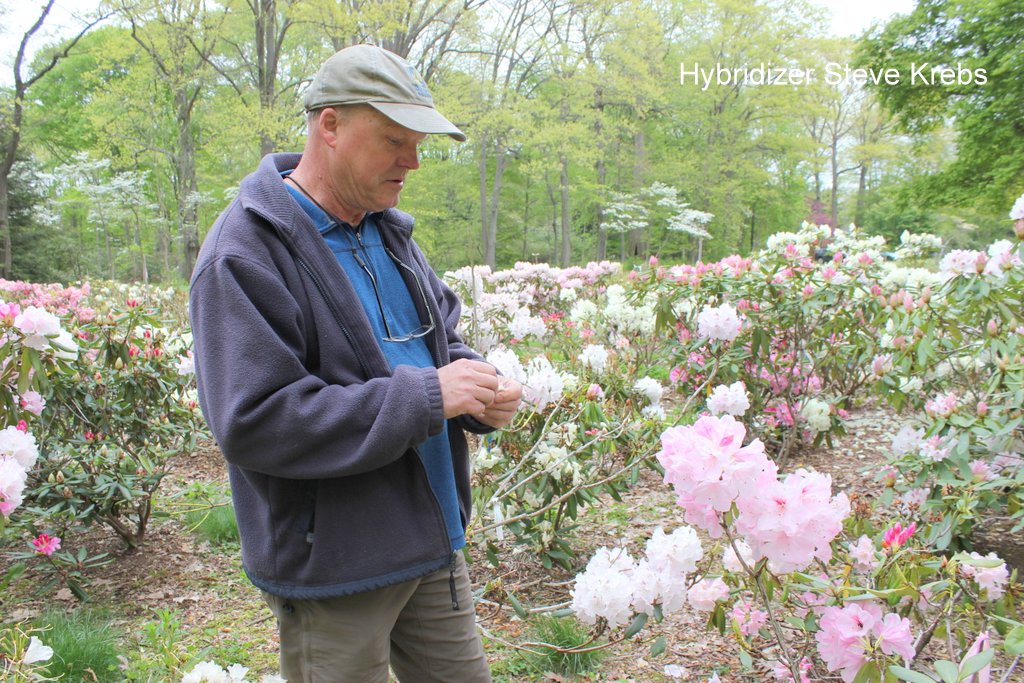
Category Archives: PERIPATETIC

Thomas Jefferson: Landscape Architect

by Greg Cada

Gardenopolis editors recently heard Greg speak on this subject at Holden Arboretum, and asked him to share his expertise with our readers.

Shortly after Thomas Jefferson’s 1801-09 presidency during which, much like today, the mud of slander and volatile allegations was slung by both parties, our third president wrote to the mâitre d’hôtel of the President’s (now, White) House:  “I am constantly in my garden or farm, as exclusively employed out of doors as I was within doors when at Washington, and I find myself infinitely happier in my new mode of life.”  Jefferson’s love of architecture and landscape design was a side of his life which also left a footprint on America.  We will briefly look at the influences and products of this aspect of his life.

National Portrait Gallery; Gilbert Stuart

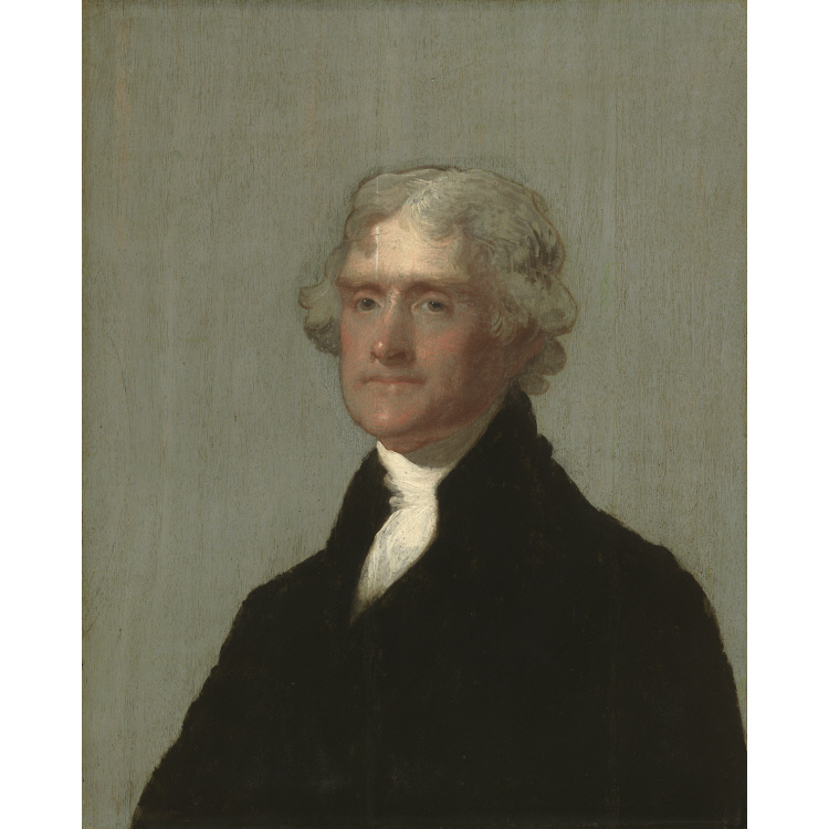
Jefferson was born on April 13, 1743 at Shadwell, near Charlottesville, Virginia, in the backwoods of Virginia to Peter and Mary Jefferson, respectively, a prominent surveyor and a Randolph.  The Randolphs were probably the preeminent family in Virginia, which provided Jefferson easy entrée to the better homes, many of which had elaborate gardens as the Colonial aristocracy favored ornate gardens to impress the populace by demonstrating their control over nature in the rugged New World.  Meanwhile, in England, where the land had long since been denuded, the trend had evolved toward restoration of natural, picturesque gardens.  The wealthy moved untold amounts of soil and rerouted bodies of water to make the land look natural.

From 1745-52, the Jefferson family relocated to Tuckahoe Plantation near Richmond on the James River, where Peter Jefferson acted as guardian of his best friend’s son after the friend died.  The Tuckahoe manor had been expanded 1734 such that from the air its footprint looks like an “H.”  This may help to explain Jefferson’s like of buildings with perpendicular extensions like shoulders and arms.

Jefferson attended the College of William and Mary in Williamsburg from 1760-62, and then read law with George Wythe, a prominent attorney and jurist.  His stay in Williamsburg and association with the Royal Governor afforded him exposure to the gardens in Williamsburg, then the wealthiest capital in Colonial America.

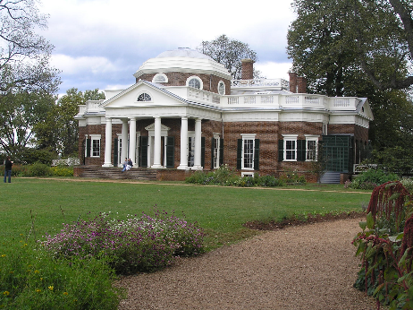
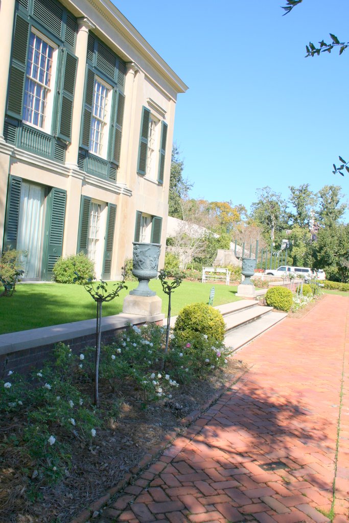
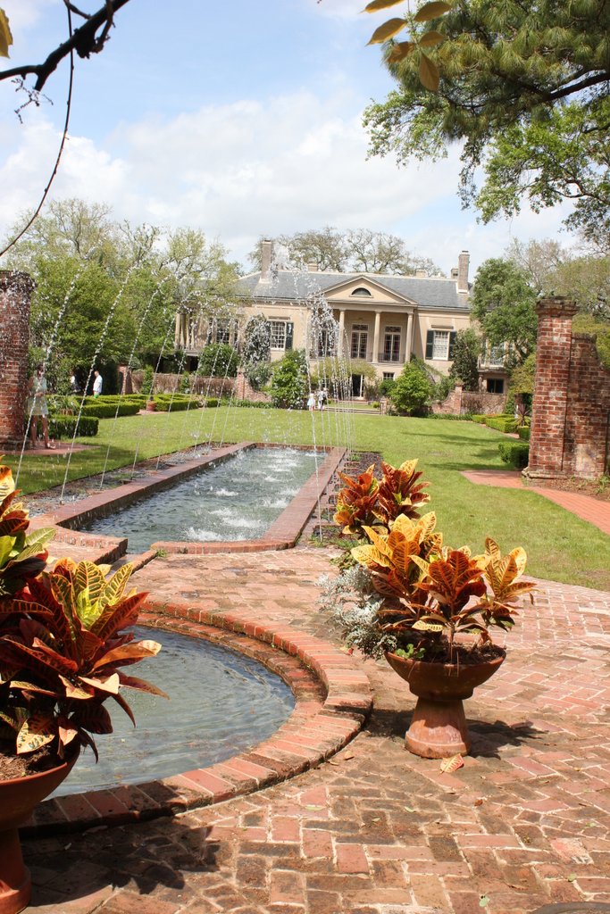
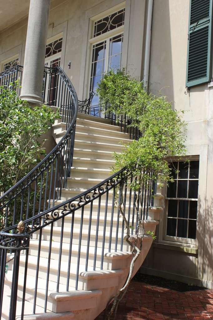
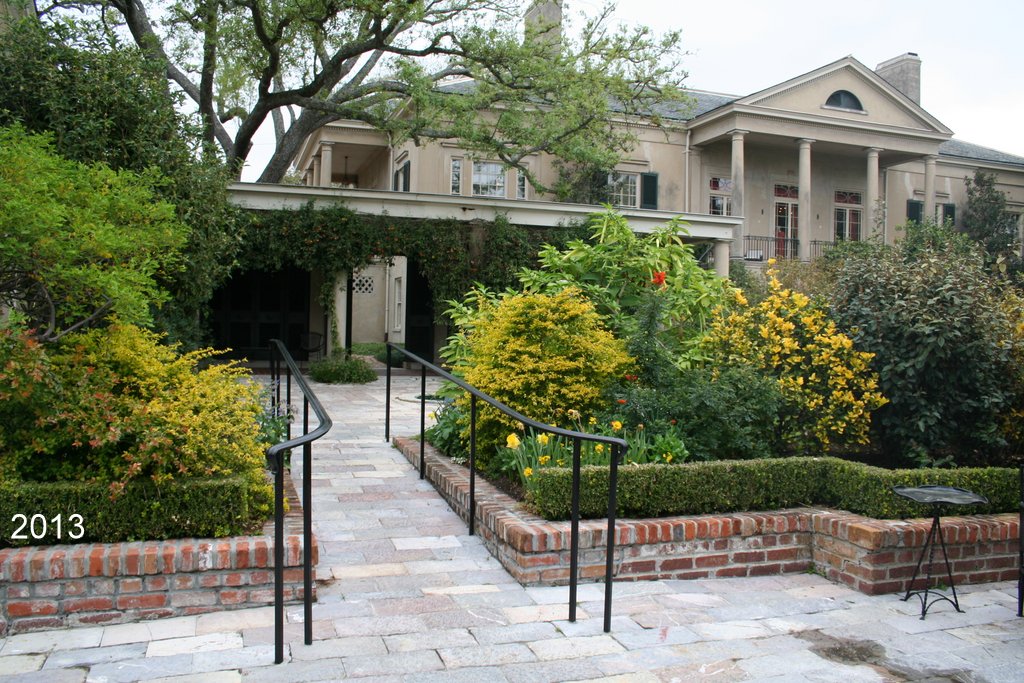
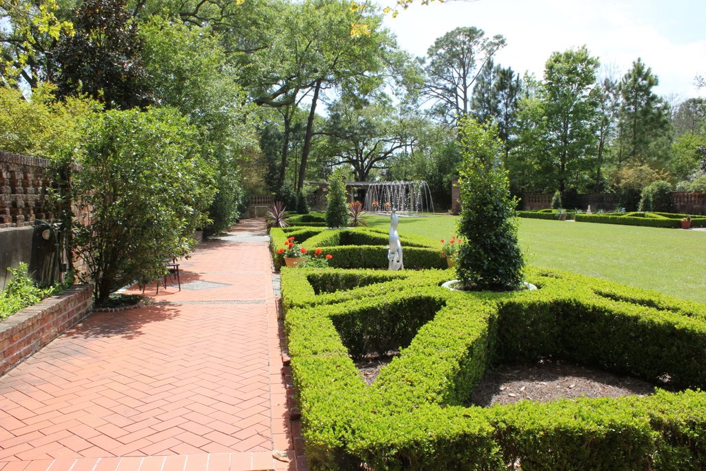
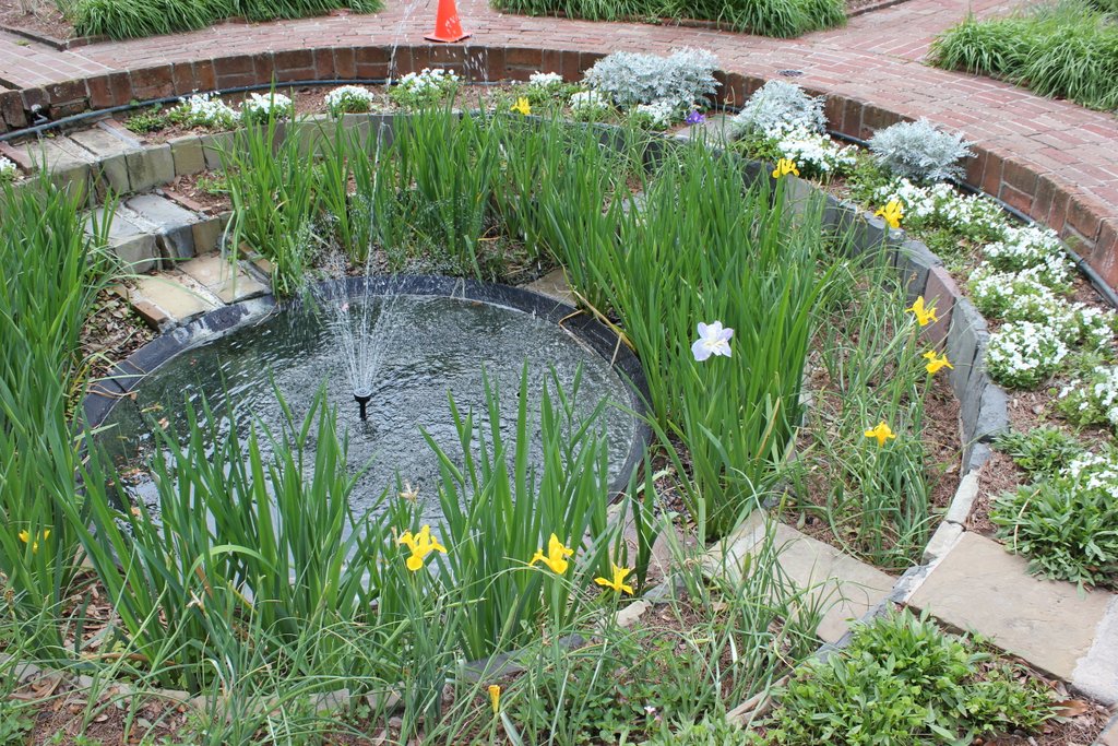
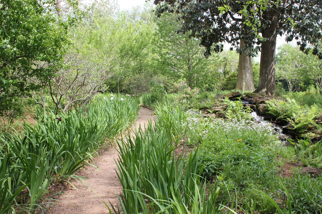
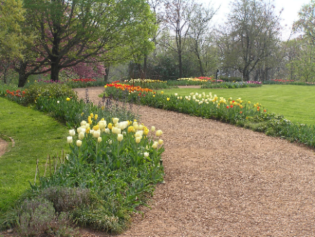
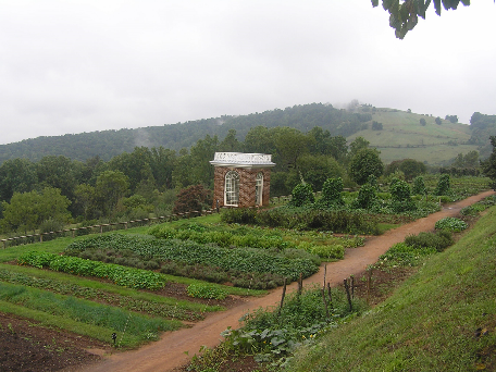
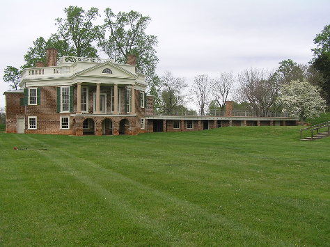
Construction of Monticello began in 1768.  The manor was central to terraces which formed shoulders and arms ending at pavilions.  A large west lawn was surrounded by a serpentine flower walk, with oval gardens at the front and back of the house.  This demonstrates that Jefferson had already rejected the formal gardens of the past, but still somewhat popular in Virginia, and adopted the newer, more-English picturesque designs.  He also had orchards, vineyards, berry squares and an experimental 2-acre, 1,000 foot long vegetable garden on a terrace.  He grew 330 varieties of more than 70 species and 170 fruit varieties of apples, peaches, grapes, and more grew in Monticello’s orchards.  Despite his efforts, his wine was never very good because native grapes did not produce good wine, and his imported European grapes succumbed to diseases.  His meticulous records indicate many of the plantings and their locations.

While minister plenipotentiary to France from 1785-89, he observed horticultural matters throughout Europe, beyond his visits to Versailles and Fontainebleau.  During a visit to Minister to England John Adams, he visited 16 English county gardens in 13 days.  After he returned to America and became President Washington’s Secretary of State, he assisted Washington and L’Enfant in the design of Washington, D.C., with some crediting him with overlaying the perpendicular street grid to facilitate transportation.  While in France, he sent various plants and seeds to America in an effort to bolster its agriculture, and conducted exchanges after his return.  He tested plants in his Monticello gardens and forwarded some plants to more suitable climates.

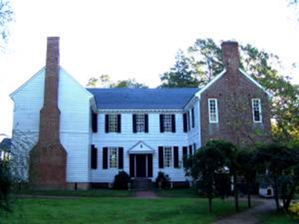
From 1806-12, he constructed Poplar Forest, his home near Lynchburg, often called his “summer retreat.”  Because it was a satellite plantation, it is a smaller home with only one shoulder.  Beyond the octagons incorporated into Monticello’s design, Poplar Forest is an octagon composed primarily of octagonal rooms—even the nearby privies are octagonal.  His writings do not indicate what was planted where, which has hindered restoring the plantings, but advances in garden archaeology have recently provided some guidance.

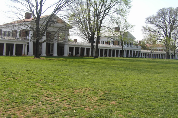
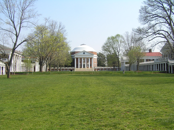
Jefferson designed and oversaw the University of Virginia’s construction from 1814-23.  It consists of a central rotunda for the library, with two shoulders connecting to arms extending downhill flanking the top of a ridge.  Each arm contained five pavilions in which professors lived and conducted their classes.  Each pavilion was designed differently for architectural instruction.  Student rooms were between the pavilions.  Below these arms, at each base of the ridge, was another row of student rooms separated by three “hotels” in which students would dine and have laundry and other services done.  The hotels lined up with the pavilions near the top of the ridge.  Each pavilion had a garden behind it running down to the lower row of student rooms, but the pavilions aligned with hotels only had half a garden, with the pavilion having use of the other garden half.  There are no records of the original garden plantings, so an eclectic variety of colonial revival gardens have been planted.

Father of the University of Virginia was among the three accomplishments he directed to be recognized on his grave marker.  The other two were author of the Declaration of American Independence and the Statute of Virginia for Religious Freedom.  He died on July 4, 1826, fifty years after the Declaration was approved.

Throughout his life, Jefferson found peace in the garden.  As he wrote to Charles Wilson Peale on August 20, 1811, “I have often thought that if heaven had given me choice of my position and calling, it should have been on a rich spot on earth, well watered and near a good market for the production of the garden.  No occupation is so delightful to me as the culture of the earth, and no culture comparable to that of the garden.  …”

This article is extracted from a Speakers Bureau presentation of OSU Extension’s Master Gardeners of Cuyahoga County Program.  For presentations, go to cuyahogamg.org/MGSpeakersBur/MGSpeakersBur.html.

Ready for a Break from Winter?

by Lois Rose

Ready for a break from the winter blahs??  Consider planning a four hour drive to Cincinnati this year to see two horticultural gems. 

Cincinnati Zoo and Botanical Garden

The zoo is the second oldest in the country.  It resulted from an infestation of caterpillars in 1872.  Residents created the Society of the Acclimatization of Birds, purchased 1000 birds from Europe and housed them, then released them in 1873, hoping they would eat the caterpillars.  The group changed their name to the Zoological Society of Cincinnati.  So what happened to the caterpillars?

first view of the botanical garden and zoo

Traveling with the Master Gardeners, we were given a guided tour by Director of Horticulture, Steve Foltz. (Tours are available for groups with a donation.)  You approach the zoo and gardens across an impressive bridge over the road, from the parking lot at a lower elevation.  One of the first things you see at arrival is a large sculpture of Fiona, the hippo, who is a kind of mascot and advertising mainstay for the zoo.  The zoo is known for the baby animals born on site, and Fiona is the best known.

Fiona the Hippo

The botanical garden is visited, along with the zoo, by 1.7 million visitors each year. The Cincinnati Zoo and Botanical Garden has held annuals trials and displays for 17 years. Over 48,000 annuals are planted and then evaluated by professional staff, volunteers as well as by visitors.  Some of the top ten for 2018 included Begonia Babywing Bicolor, Begonia Megawatt series, Canna Cannova Bronze Scarlet, Coleus Main Street Wall Street, Euphorbia Diamond Mountain and Helianthus Sunfinity. View 2018’s top performers here.

gorgeous mass plantings of annuals

Annuals are used as mass plantings throughout the zoo and in containers. They are a magnet for pollinators, providing nectar and pollen through the season.  (There is ongoing controversy about the relative merits of natives versus cultivars (nativars) for best pollination success. E.g., Monarch butterflies might benefit from pollen or nectar from non-natives but need native Asclepias (milkweed) to lay their eggs.)

In addition to its outstanding displays of annuals, the Horticultural staff has made a serious effort to include hardy plants as well as tropicals that add a flavor to the areas surrounding the animal displays. Bamboo for example is used extensively, as well as perennials and bulbs like Colocasia (elephant ears) with large and interesting leaves to simulate tropical growth.  Large leaved magnolias are used effectively in this way.   Water features, rock outcroppings—natural and artificial, wandering paths that twist and turn, elevation changes, surprises around the next corner—this is an interesting and for those with limits on walking, a challenging tour.

lots of annuals and tropicals
flamingoes passing by

Smale Waterfront Park

For its first 50 years Cincinnati was a village on the river, between Fourth Street and the Ohio. In the 1830s, a building boom expanded the so-called Bottoms neighborhood into a crowded area with the Public Landing as its center.  By the start of World War 1, the area was deteriorated and undesirable.  Until—a few years ago, the space close to the John A Roebling Suspension Bridge (am I in Brooklyn?) brought adventure playgrounds, gardens, swings for grownups—in short, a dramatic and welcomed transformation.

Smale Riverfront Park

As of February 2015, almost $97 million in funding had been secured to construct Smale Riverfront Park, a $120 million project: 20 million was given by John Smale in honor of his wife. The cost per acre to construct was estimated around $2.7 million, compared to Chicago’s Millenium Park at more than $17 million per acre.  An early estimate was that upkeep per year would be around $600,000.

Chosen as designers in 2001, Sasaki Associates were inspired by input of citizens at a series of public meetings and focus groups beginning in 1998. Their design plans fitted into the Park Master Plan, created by Hargreaves Associates and approved in 1999 by pretty much everyone in power.

From a tourist’s point of view, the most impressive feature of the park is probably the John A Roebling Suspension Bridge which was created by the same designer as the Brooklyn Bridge.  Its blue towers stand out over the riverfront, visible from everywhere in the park.  The riverfront baseball stadium, The Great American BallPark, home of the Cincinnati Reds (oldest franchise) is right next door. In fact, on a previous trip, I was able to watch the big screen in the ballpark during a game while I was standing half way across the bridge from Covington. (Pete Rose was there. Wow.)

The park splays out along the river with wandering paths, water features, gardens, playgrounds—in short, much to do for children and their parents.  Away from the river and a roadway, and up some impressively designed stairs with water rushing down beside them, the carousel sits in a fine spot for looking down over the park.  Nearby is a Ferris wheel with great views from the top and further up there are shops and restaurants nearby.

Be sure to try the rope bridge—a little intimidating but worth it.  There are some rocks to climb, a large piano which you play with your feet, stones to leap on in a man-made stream, and many flower beds throughout.  The rose garden is lovely with annuals full of butterflies and bees as well as a variety of well-kept roses.

The swings under a handsome trellis offer a respite and a great view of the river. Speaking of the river, it flooded last year and the park was once again the Bottoms of old. But it seemed very well maintained and as good as new when we were there.

Revisiting Rockman, and Other Exhibits Concerning Art and Nature

by Elsa Johnson

Community

Recently several of Gardenopolis’ editors traveled to the Toledo Museum of Art to see the installation by Rebecca Louise Law.  Composed of a vast multitude of infinitesimally thin wires of natural and artificial materials hanging/descending from a two story ceiling, this was a magical experience, as the pictures show.  Originally installed when most of the materials were fresh, by the next to last week of its run, when we saw it, the flowers, seed heads, and leaves were desiccated, but still entirely recognizable, and often still quite colorful. It was quiet inside the hall in which they hung. If people talked to each other, it was quietly, as if it would be wrong somehow to impose on what was a kind of meditation. There were subtleties to be enjoyed, such as the muted mysterious shadows of the plant materials reflected on the walls by the muted lighting.

Re-visiting Rockman

About a month or so ago we ran an article on the Alexis Rockman art exhibit at MOCA Cleveland: The Great Lakes Cycle (also now closed). That article spurred a query from one reader about why fertilizer contamination is currently a problem in the agricultural lands of northwestern Ohio. To whit: “I thought there were regulations in place.”

Around the same time that I visited the Rockman show, I also attended a panel discussion held at the Cleveland Museum of Natural History on Lake Erie. Two of the participants in particular spoke to this issue, Dr. Laura Johnson, Director of the National Center for Water Quality Research, Heidelberg University, and Dr. Jeff Reutter, former director of Ohio Sea Grant and Stone Lab. They were two of four panelists. The following is my attempt to corral their part of a discussion — that necessarily jumped about a good bit — into a single organized presentation. Any errors are entirely my own.

What we know: Our lake is a finite resource. It is the 13th largest lake in the world. It is the shallowest of the Great Lakes, and because of that, it is the most productive as a fishery. But this shallowness also makes it extremely vulnerable. The lives of 3,500 species are tied to the health of the lake. Many are now endangered. What happened?

We know that the highly productive farmlands of northwestern Ohio are the result of draining what once was called the Great Black Swamp, a formidable wetland monster that was tamed for agriculture by a system of underground drainage that carries water off the land into ditches, and thence into the natural watershed (primarily the Maumee River). We know that modern farming involves fertilizers, both natural and chemical, being applied to the land at the start of the growing season. But fertilizer doesn’t stay put. Inevitably some of it gets into the watershed. In the late 1960’s people realized the shallowest part of Lake Erie, the Western Basin, was, as a result, becoming a giant cesspool. Regulation followed, and, for a time, it was better. Around the year 2000, however, the quality of the water again took a turn for the worse. Here are two of the panel members explaining this.

Dr. Jeff Reuter: Mid 1990 to the present has seen an increase in dissolved phosphorus entering the lake, which is a form that is very easy for the harmful algae to use. In 2008, 3,800 tons of phosphorus entered Lake Erie from the Maumee watershed, the largest of Lake Erie’s tributary watersheds.  To reduce phosphorus from agriculture entering Lake Erie, we are using a system of voluntary incentives and disincentives meaning that we are offering only carrots, not sticks. We are also seeing the impact of climate change, with more severe storms producing more run off. The system sets up a false dichotomy of farm economy against lake economy (that lake economy is valued at 14 billion dollars).  We want both.

Dr. Laura Johnson: It does not take a lot of phosphorus in the warm shallow waters of the western basin to cause a nuisance problem…. i.e., a lot of farms, leaking a little bit. Most farmers now apply at recommended rates and data suggests that application of phosphorus and removal via crops is largely in balance. The best reasoning for the losses is that phosphorus application on the soil surface associated with broadcasting in the fall combined with the massive system of subsurface tile drainage is allowing for excess dissolved phosphorus loss. Thus efforts should be focused on nutrient management- that is applying phosphorus at the right rate, time, and place.  For instance, some studies suggest inject phosphorus fertilizer deeper than 2 inches in the soil could reduce losses by 60%. However, there needs to be more incentives to provide the appropriate technology to farmers to increase the use of this practice. 

We’ve had some extremely large blooms since 2008, some of which were very toxic.  The toxin produced by these cyanobacteria, Microcystin, is more toxic than cyanide. Although these toxins are filtered out at the drinking water treatment facility, the costs have increased drastically and can be over $10,000 a day in Toledo during bad blooms years.  The high level of toxins entering this plants could get to a point where it overwhelms filtering capabilities.   At the present time the western basin is the most affected, but the blooms in the western basin move over to the central basin threatening water intakes there as well.  The central basin also has different blooms that prove challenging for the region.  Clevelanders will be relieved to know that, unlike Toledo, Cleveland has multiple water intakes, thus, Cleveland’s water supply is not as vulnerable.

An artist of our own

The artist Charles Burchfield was born in Ashtabula Harbor (I am taking this from explanatory material from the exhibit – and I don’t know about you, but upon reading this I found myself hoping he wasn’t literally born in Ashtabula Harbor), and studied at The Cleveland School of Art (now CIA). After WWI he returned to northeast Ohio. Burchfield, like Rockman, was a watercolorist, but to a very different purpose. Both are representational painters, but where Rockman uses his considerable skill to create hyper-realistic paintings that are muralistic, that tell a story of environmental purity and degradation over time, Burchfield used color and form in small paintings that express personal emotion and mood through landscape. For example, in the picture of the tree with the branches reaching up to a glowing sun, Burchfield suggests the divine influence he saw in nature.

In another painting, the accompanying sign explains, an orange stream divides an area of barren yellow from an area of lush green, suggesting the impact of mining – often abandoned after the resource had been depleted — on the eastern Ohio landscape.

Even Burchfield’s pencil drawing of a chestnut tree, while explicitly representational, seems deeply imbued with mood.

The Burchfield exhibit is current and can be found in the small gallery opposite the gift shop at the Cleveland Museum of Art. A reminder for seniors: if you are a member, parking is free on Tuesdays.

Exploring the Paine Creek Parks

by Elsa Johnson

Parks play an important role in greening a metropolitan area—including the parks that are not actually within the city itself. Cleveland is lucky to have an especially rich park system close in.  But Cleveland area people often miss some cool parks that are a little further out —  close by but not real close by – and a bit harder to get to. From the eastside. It’s easy to get to Holden Arboretum; the Lake County parks that are close by Holden are hard to miss and draw a lot of visitors – like Penitentiary Glen. But way out on the farthest fringes of Lake County there are a collection of not so easy to find parks with some unique features. As a long-practicing landscape designer I have often gone to Klyn Nursery. It was easy to get to Klyn’s via Route 90 and Vrooman Road. When I would get to the bottom of the hill on Vrooman, before it passed over the bridge crossing the Grand River, I would notice a gravel and dirt road that turned right and wandered off ….somewhere.  The road less traveled.  It always intimidated me a little bit, looking  isolated and rough, as it did, and I was on my ‘getting plants’ mission anyway. So I’d pass it by. Then they (the ubiquitous ‘they’) closed the Vrooman Road bridge. So I found myself looking for other ways to get to Klyn’s, and began exploring the back roads, and In doing so I discovered a trio of interesting parks.

I’ve written before, I believe, about Indian Point Park, which is where you find yourself if you if you take that road less traveled. Paine Creek, a small tributary stream to the Grand River, enters that larger flow at Indian Point. Yes, there’s a real legitimate reason it is called Indian Point, and you can discover it via the Lake county Parks website. You can climb up to the top of the point for a view out over the Grand, an Ohio Wild and Scenic River. In the springtime the forest floor here is covered in Virginia bluebells; and in a few weeks there will be glorious fall color. Then, were you a duck you could swim or waddle up Paine Creek, pass under the I-90 freeway, and, not too much further on, arrive at Paine Falls Park. But if you are human, you will have to use your phone navigator or an old fashioned map and zig here and then zag there. The duck will arrive first.

From Paine Falls Park, if you are a duck, having flown to the top of the falls, you will continue up the Paine Creek stream and soon arrive at Hell Hollow Wilderness Area. But if you are human, you’ll get in your car and zig and zag again, and eventually, with luck, find yourself at the same place, but at the top rim of the hollow rather than down in the bottom with the duck.

The charm of the Paine Creek parks and the Hell Hollow Wilderness Area is not to be found in a long hike – there are no long trails – rather, the charm lies in the intimate exploration of Paine Creek (even though you’re not a duck, you get to play in the water). But at Hell Hollow, before you do that, you have to walk down two hundred and sixty three steps (remembering that what goes down must come back up again).

There are great views from the rim trail out over the hollow to the creek below.

The creek bed is shale, not mud, and on a warm summer or early fall day, with the water low, wearing water sneakers, we walked both along and in the water, feeling like explorers, noticing the creek side vegetation (knotweed even here!) and the tiny darters dashing from one sheltering stone to another. Nowhere was the water higher than my ankles.  A young naturalist we came across in the stream showed us a crayfish he held in his fingers, a sign of the unpolluted quality of the water.

I should note that in higher and colder water this watery exploration probably would not be a good or safe idea.

These three destinations put together would make a nice day trip for a city dweller, or someone looking for a little adventure, although I find myself wishing that somehow these three parks, so well connected by nature, were better connected by and for people, so that one could explore them as a continuous hike.

Perhaps someday.

The peripatetic gardener visits Roan Mountain, Tennessee

by Elsa Johnson

I’ve been in the Appalachian mountains before – well, to be honest, mostly I’ve driven through. Nonetheless, It’s a place that always moves me — the way the ridges lie parallel to each other into infinity. Route 80 in Pennsylvania is one such route where you ride the old rounded mountains lengthwise the whole way, from one end of the state to the other. Those rounded mountains alternate with broad gentle valleys of farms and fields; one can imagine surviving in that pastoral land — possibly more than just surviving. Then there are the mountains one drives through in West Virginia, where, as I pass through, I always wonder – what do people DO in this land? How do they live? It’s so challenging. On route 77 you pass through a tunnel to enter into Virginia, where the land changes in subtle ways. It is a bit gentler. I expected Roan Mountain to be like that. But it’s not.

Roan Mountain is part of the Great Smoky Mountains, which are a subrange of the Blue Ridge Mountains separating North Carolina and Tennessee just north of the Blue Ridge Parkway. Although I’ve been in the Blue Ridge before, and thought I knew what to expect, view wise, Roan Mountain has taken me by surprise, the very blueness, the mists, the way the clouds hang in the mountains, pulling away and then rejoining, as though they cannot bear to be separated — the way the mountains seem to breathe the very clouds into being. And, of course, in fact, they actually do. I am enchanted. Bemused. Though I still am wondering, what do people DO here?

Our first hike on Roan Mountain was a short one. My sister-in-law lives on Roan Mountain, in a house with a wrap-around porch, like so many here, and the sound of a rushing stream in the near-by woods (it’s been a record wet summer). All we had to do was keep going up on the winding, twisty road that goes past her house — on up into the Cherokee National Forest, where we parked, and hiked a short flat distance to a knob that looked north over a valley in Tennessee.

From that perspective the land looks relatively unpopulated. I have learned it isn’t. Tucked away in all that so green vegetative excess are winding roads and along those winding roads are houses sheltering under all that greenery (What do people DO here?). If one could see the houses it would seem almost suburban other than there’s a vast forest right out the back door, and probably a fast running stream, and bears come by regularly to check and raid any hanging birdfeeder.  But up on top of the mountain (elevation 6,285 feet – we weren’t quite that high at the knob) you can’t see any of that. You just see trees … and mountains …. and more tree …. and more mountains …. and trees ….

We also visited the rhododendron ‘gardens’ on this first trip, growing thickly together, with White Snakeroot (Ageratina altissima) growing underneath. Altitude is the determinant for what one finds growing on the mountains. The rhododendrons grow at a high elevation in the company of Frasier firs and male ferns. 

Also growing at this elevation were Witch Hobble (Viburnum lantanoides) and fothergilla. I was fascinated by what I have learned is Mountain Angelica (Angelica triquinata), which is geographically limited, growing only in (I discovered) in a limited distribution from northeast Georgia through Pennsylvania. It grows voluptuously here on the highlands and balds of Tennessee. The ones we saw at the knob were covered with flies, but were also visited by ever moving butterflies.

On another day we almost hiked up to Grassy Bald, the high point, where you can look out in every direction. We made it past Jane Bald but pooped out on the lowest slopes of Grassy Bald. The distances here, as seen by the human eye, are deceptive. That slope that looks like an easy short climb? Let’s just say you were warned. Grassy Bald is the Roan Mt. highpoint – where the native flora is the most pristine. To get to Grassy Bald you first hike up through a meadow and then pass through a dense stand of firs carpeted underneath with ferns, and come out onto the first bald – where you discover it’s just the first one. No part of this hike was level – you were either going up, or going down.

Mountain angelica was plentiful on the balds, but – strangely, there were no flies on them.  We also found blueberries (tiny and tart), compact miniaturized ninebark, white achillea, goldenrod (I think) and what I am calling ‘mystery flower’ (looks a bit like a liatris – if anyone knows what it is, feel free to tell me).  And bear scat.

Another hike took us to Elk River Falls, where a congregation of a dozen or more yellow Tiger Swallowtail butterflies refused to cooperate for a group photo, although a Black Swallowtail did, barely.

A hike in Roan Mountain State Park, at much, much lower elevations, brought us to hillsides of towering tulip poplars underneath which grew carpets of native wild ginger (asarum canadense) as a groundcover. I have never seen anything like it! Also growing on these hillsdes were Christmas ferns, male ferns (a dryopteris species), Doll’s Eye’s  (actea), various carex species (appalachia, plantaginea, platyphylla), native bamboo (Arundinaria appalachiana), and partridge berry (Mitchella rpens),  Nearest the stream were the usual late summer meadow volunteers, but also what I believe to be Indian Plaintain (Cacalia atriplicifolia). Also a charming little orange salamander. Not so different from what grows at home in northeast Ohio, but more generous.

A final outing took us to the Chihuly glass exhibit in the Biltmore gardens where strange glass plants resided among the real plants, sometimes successfully, sometimes less so, sometimes spectacularly.

Destination Garden in Madison: Rhododendrons of David Leach

by Lois Rose

In 1970, on the eastern end of Lake County, David Leach found a perfect thirty acres on which to hybridize rhododendrons.  Only a short distance from Lake Erie, this lovely garden houses many of his hybrids plus the experiments and successes of the new team, headed by Stephen Krebs, who took over after Leach died in 1998. Krebs is trying to develop resistance to fungal root rot in his hybrids.

Leach initially became well known for his knowledge and hybridizing skill with the publication of his book, Rhododendrons of the World, in 1961. He was an avid art collector and went on trips for collectors to Europe and elsewhere.  He also visited the ancestral homes of his favorite rhododendrons.

The process of hybridizing involves taking pollen from a plant of interest and transferring it to another plant which is then isolated from other pollen using a bag over its flower.  It can take up to 25 years from germination until possible retail success.  Leach developed 80 such hybrids many of which went to market.

The property is located off of Route 528 in Madison. It includes a scenic pond which comes to full eye -popping beauty with the blooming of the yellow iris.  There are test fields and greenhouses,  thousands of spring flowers, wonderful flowering trees and shrubs in a woodland setting in addition to the azaleas and rhodies.  

Leach left his property to Holden Arboretum in 1987.  Holden members are frequently given a day in which to visit the David G. Leach Rhododendron Research Station, as it is officially called. Tours are given by knowledgeable guides.  Be on the lookout next May for a date.  Garden Clubs can also arrange for tours.

If you are a camera buff and like rhododendrons or azaleas, this is nirvana.

Longue Vue in New Orleans

by Lois Rose

Visiting my hometown New Orleans in March, I was impressed with the height of the Mississippi River at full tilt, and by a wonderful garden called Longue Vue.

Longue Vue Gardens, New Orleans

The house and gardens were the property of local philanthropists, Edith Rosenwald Stern and Edgar Bloom Stern. William and Geoffrey Platt were the architects working with Ellen Biddle Shipman creating the last Country Place Era estate built in America.

Longue Vue operates as an historic house museum and garden open to the public year round. It describes its mission, inspired by “our humanitarian and artistic legacy”, to be a leader in advancing innovative thought, creative expression and life-long learning.

When we arrived there was a serious Easter egg hunt on the grounds.

Sixteen garden “spaces” lie around the lovely house and surrounding eight acres off a short street and a pine drive (1942) next to one of the canals that flooded during Hurricane Katrina in 2005. When the garden was heavily damaged by the contaminated flood waters that remained for weeks, gardeners from around the world flocked to the site over the next years and helped to rebuild the garden and restore it to its former glory.

I saw Longue Vue soon after Katrina and twice since then.

I am including some photos from my previous trips for perspective on its evolution.

Large mature live oak trees flank the main path leading to the forecourt and the house from the parking area.

Moving to the left of the house from the ticket area you pass through an azalea walk, mostly gone by on this trip.

Next is the small pan garden with a sculpture and a fountain and seating area up against the house.

As you move around this side of the house you can see over a small lawn to the New Orleans Country Club golf course with huge oak trees, sand traps and of course golfers.

The main framework of the garden extends from the imposing double outdoor staircase on the right side of the house.

A charming yellow garden can be found off of the portico terrace in front of the staircase.

The large lawn defines the Spanish court and is flanked by decorative brick walls with insets of fountains and plantings in borders and containers.

Looking through openings in the brick wall you again become aware of the golf course, but it is cleverly obscured.

At the farthest end of the lawn from the house one of five structures in the garden blocks the view of a long sunken water rill at the center of the canal garden with a fountain.

A total of twenty four fountains and ponds appear as you walk around the grounds. A pair of ducks seemed at home in a secluded small “goldfish” pond to the left.

Going through an opening to the right reveals a walled garden room with a variety of iris at the center sunken several levels below the outer path.

Interesting fruit trees and flowering shrubs are featured throughout. Moving out from the walled room an iris walk leads to a wild garden and eventually to another water feature and a pigeonnier.

A children’s discovery garden has some unusual and innovative features including a bamboo tunneled entrance.  Sweet olive, a very fragrant shrub which was in full bloom provided a wonderful curtain of perfume as we sat under its branches.

The 22,000 square foot house contains decorative arts from the 17th-20th centuries, English and American furniture, ceramics and mid-twentieth century op and kinetic art.

The garden alone though is worth a visit.

Adventuring into the South

by Elsa Johnson

I recently took a driving trip to visit friends and family in the South – Clover, South Carolina; Savannah, Georgia; and DeLand, Florida (a little northeast of Orlando), with half of a day stop in St. Augustine (where we happened upon a Celtic Festival parade). Frankly – too much driving, but the stays in the actual places – lovely.

[singlepic id=619 w= h= float=none]

A highlight was a daytrip on the St. John River, which I never even knew existed. It is 310 miles long, flows north to Jacksonville, with a drop of less than 30 feet over the length of its fall, so it is very lazy and winding, and links with many, many lakes and loops — a very watery environment that would be easy to get lost in. One part of the St. John River looks pretty much like another (hence, no pictures to entertain you) – but we saw all kinds of animal life: several species of herons, ospreys, kingfishers, egrets, yellow swallowtail butterflies, alligators (looking like someone threw out an old tire, lying there amid the foliage of vegetation), and manatees. Manatees! Hard to see in the black water unless they swam up close to the surface. We cut the motor way down and watched, and did see them, the big lumpen bodies with their spatula tails that make a characteristic pattern of ripple in the water as they move.

The other highlight was visiting the Daniel Stowe Botanical Garden in North Carolina (just over the S. Carolina line). This is a relatively new garden, dating to 1999, which I’ve visited before, in showier seasons. This time the main gardens weren’t much to look at, there wasn’t much in bloom – a Chinese Fringe Flower tree, hellebores, daffodils, a magnolia that had been burned by the cold – but I was charmed by the addition of a children’s garden, opportunely sited on a hillside that might actually wear active little bodies out. What a good idea! I also enjoyed the conservatory, which I had not visited previously.

[ngg_images source=”galleries” container_ids=”44″ exclusions=”619″ sortorder=”619,640,639,610,620,611,612,613,615,616,617,614,618,621,622,623,624,625,626,627,628,637,629,630,631,632,633,634,635,636,638″ display_type=”photocrati-nextgen_basic_slideshow” gallery_width=”600″ gallery_height=”400″ cycle_effect=”fade” cycle_interval=”10″ show_thumbnail_link=”1″ thumbnail_link_text=”[Show thumbnails]” ngg_triggers_display=”never” order_by=”sortorder” order_direction=”ASC” returns=”included” maximum_entity_count=”500″]

Sorry to report Bradford/Callery pear is growing everywhere, both in urban areas and in the wild, in Virginia, North Carolina, and South Carolina. It is the street tree of downtown Clover (two blocks long – blink and you’ve missed it) – nobody loves it.

Dreaming of Spring? The Peripatetic Gardener Reports on Her Travels

by Lois Rose

Cornell is located at the bottom of Lake Cayuga-far above the waters, right? It is approximately five and a half hours from Cleveland, a lovely drive if you take the cut off of 90 through the Southern Tier—mountains, valleys, rivers and streams—well worth it.

The campus contains a large number of gardens but my favorite is the Botanic Garden which includes ornamental and useful herbs, interesting vegetables, perennials, grasses, an amazing bioswale garden, containers and other displays of shrubs, trees, groundcovers.

Many of the herbs are displayed in raised beds, or elevated on the sides of the main garden.


Around every turn is something of interest, like the tree which has a hole cut in its middle, still living and producing huge leaves.(Catalpa I think). 

The drought over the months before we visited had taken a toll but there was still much to see.  Mediterranean plants, those that love the heat, were as happy as a clam in high water. 

Others had ostensibly succumbed and been replaced.  It takes several hours to really see everything in this space, including the containers crammed with diverse and unusual plants on display near the visitor’s center which incidentally has top notch merchandise much of it devoted to gardening.

Cornell is feverish on Saturday morning, and visiting the Farmer’s Market is a treat if you can find a place to park.

[ngg_images source=”galleries” container_ids=”32″ exclusions=”420,421,426,429,431,432″ display_type=”photocrati-nextgen_pro_masonry” size=”180″ padding=”10″ ngg_triggers_display=”always” captions_enabled=”0″ captions_display_sharing=”1″ captions_display_title=”1″ captions_display_description=”1″ captions_animation=”slideup” order_by=”sortorder” order_direction=”ASC” returns=”included” maximum_entity_count=”500″]

The Peripatetic Gardener Discovers Lake Erie Bluffs Park

by Elsa Johnson

Thirty years ago, back in the day when I was studying landscape architecture at the Ohio State University, I had the good luck to be hired one summer as an intern for ODNR, tasked with driving the Lake Erie shoreline from the Pennsylvania border to downtown Cleveland, looking for access to the lake. What a great job for someone who likes to wander off the purposeful route just to see what’s there! For pay I got to drive down every north facing paved and unpaved byway leading toward the lake….and what I found was that while access to the lake was very limited, there were several areas where sizable swaths of undeveloped land remained. I could imagine all kinds of things to do with them, but mostly I imagined parks.   

So it was with (unchanged) curiosity that I set out with my husband recently to explore the brand new lookout tower in Lake County’s 600 acre Lake Erie Bluffs park, which, itself, is quite new.

1030161432c

Lake Erie Bluffs park is located a little east of Fairport Harbor, and a little west of the Perry Nuclear Power Plant, and offers the visitor access to almost two miles of undeveloped Lake Erie shoreline. It was a misty moisty morning – one of those days when all edges seem blurred and softened, as if the thinnest, finest pale veil had been thrown over everything. Soft weather.

1030161448

We parked at the Lane Road entrance, took a look at the trail map, and headed east along a nicely level crushed stone path in search of the tower.

1030161508

At 50 feet high, this tower is 70 feet shorter than the Emergent Tower at Holden Arboretum, but because it is set on a bluff that is itself about 50 feet above lake level, the end viewing effect is much the same – one looks out over the tops of (here) mostly young growth trees, and, to the north, to the platinum colored lake with it’s waves unendingly washing ashore.

1030161444

We hoped to spot a bald eagle’s nest from the tower but did not, although we did see eagles, and, of course, gulls (and a titmouse and a chickadee). In the spring and fall the southern shore of Lake Erie provides an important stopover for migratory birds, but alas, we did not see any. I found myself wondering how close we were to the nuclear power plant, but looking east, I could see nothing but a grey fog veil.

On the return trip we chose to walk the beach trail, right along the water’s edge, which was marked ‘easy’. While everything in this park is pretty level – there are no serious or dangerous challenges – the beach trail is not really ‘easy’. The beach, mostly made up of stones of varying sizes interrupted by driftwood of varying size, provides an unstable walking surface with plenty of obstacles. For someone who has had two hip replacements in the past 8 months and is still a little unsteady on her feet, this half mile beach walk was difficult. But looking back to the east after one near tumble, suddenly, there it was – Perry Nuclear Power Plant, the two towers rising above the trees, and not too distant.

1030161536

In the other direction one could just make out the lighthouse at Fairport Harbor, a tiny bump poking out into the lake.

Our exploration covered the eastern half of the park’s trail system, a total of about two miles. There is an equal amount of trail in the area of the park lying west of Lane Road, which we did not explore. 

1030161432

If you go: We took 90 to the Vrooman Road exit, then north on Vrooman, over the bridge (closed to semi-trucks but not to cars), a hard right at the top of the hill, then left on Lane Road. Stay on Lane to reach Lake Erie Bluffs. Another park of interest in this area is Indian Point, access to which is just before the Vrooman Road Bridge. Indian Point overlooks the juncture of the Grand River and Paine Creek.